
We create software to simplify the complex.
We design web tools where technical power translates into absolute simplicity for the user. Experts in digitalising operational processes and integrating geographic intelligence so that asset and water network management is, at last, intuitive.
Want to publish maps with your data quickly and easily? Discover gis2web →
Specialized web software
We build solutions that improve real workflows. We integrate AI at the points where it reduces workload and simplifies processes.
Systems with Geographic Intelligence
We connect inventory databases to advanced capabilities: real-time asset visualization, location-based workflows and integration of geospatial data into operational platforms.
Infrastructure & Water Cycle Management
Software for water supply and sanitation networks. Cut algorithms with minimum user impact, hydraulic sewer maintenance and sector planning.
Maintenance & Field Operations
Asset management with a geographic component. Event-driven work order activation, simplified data capture for field operators and automatic linking of equipment and incidents.
The complexity is ours, the simplicity is yours.
At Vidro, software engineering is measured in clicks saved. We are obsessed with eliminating friction from workflows.
Maps that work for you
We don't just put dots on a map. We build tools with a geospatial component that let you manage inventories, plan maintenance or analyse water networks visually and logically.
User-centred design (for real)
We take on the algorithmic load and business logic in the code so the user is met with clean interfaces and guided flows.
AI for efficiency
We implement Artificial Intelligence with a clear purpose: predicting events, automating data entry and helping users make faster decisions.

Publish interactive maps on the web with full GIS capabilities. Compatible with any geospatial source: databases, WMS, WMTS or geographic files. Available as SaaS or on your own servers, with a white-label system to adapt the look & feel to your brand.
Discover gis2webGeoGMAO
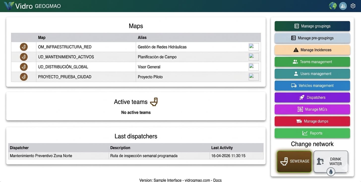
The CMMS where the map is the engine. Plan work orders directly on the map, assign routes to your field operators and centralise all information in real time. No paper, no chat apps, no manual errors. Validated with leading water utilities.

Compatible with Giswater
Our maps are 100% compatible with the Giswater database, the open source standard for water supply and sanitation network management. The system connects directly to the Giswater inventory and runs algorithms on its data: network cuts, sector planning and hydraulic analysis. Vidrosoftware is a member of the Giswater Association.
Visit giswater.org →Member of the Giswater Association
Does your ERP not do exactly what you need?
We develop custom software to complement your ERP: geospatial modules, data connectors, field operator apps or workflow automation. Your operation, without limitations.
Tell us your case